PennState Public Broadcasting released the first episode of Geospatial Revolution Project in Sept. 2010. That video highlighted the utility of GPS, second video showed how maps made cities more personal and the third one highlighted the use of digital mapping in Police work. Now the fourth and final episode is live which showcases the utility of geospatial technology in monitoring global climate change, preventing famine, tracking disease and mapping communities.
World’s most wanted terrorist Osama’s game is over. Internet is abuzz with twitter updates, news and blog articles about the operation and its aftermath. World’s leading high resolution satellite image provider GeoEye has released latest satellite image of the compound in which Osama was said to be hiding. Also available is a video of how the compound changed between 2005-2011.
I am a full-time user of Ubuntu, world’s most popular free operating system. I run GRASS GIS and Quantum GIS on my Ubuntu. April 28 is a memorable day for Ubuntu users as it marked the debut of new Unity interface which is a boon to usability. Unity has redefined the Linux Desktop and I laud the efforts of Canonical for taking the revolutionary decision to implement a new desktop environment. I am sure this decision will take Ubuntu a long way.
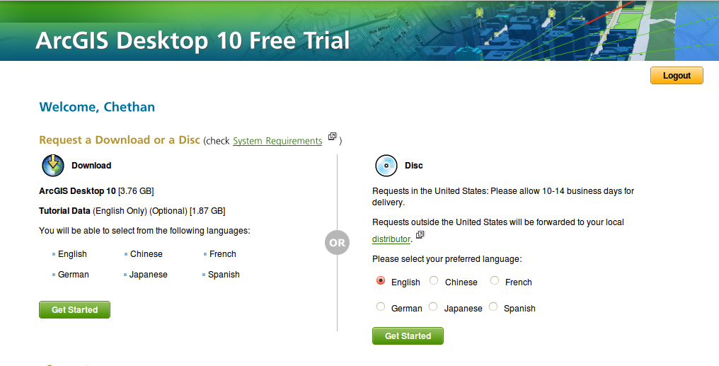
In June 2010 I had written about esri’s highly restrictive policies regarding making their software available for common users. See, ArcGIS 10: My big question for esri. Later for my academic project, I switched to FOSS GIS - GRASS GIS and Quantum GIS. Today I was casually browsing esri site to check if anything had changed over this duration. I was pleased to see esri now provide 60-day trial of ArcGIS, that too at ArcEditor license level plus several extensions. I had already logged in via my esri global account, so just had to click the link Get Your 60-Day Trial Now to be taken to a page with download or order options.
Option is also provided to download 1.87 GB tutorial DVD. So now one can experience the full power of ArcGIS. We must remember that so far (till version 9.3 and earlier stages of 10 release) getting a beta/trial/evaluation copy of ArcGIS was the privilege of under maintenance/support customers. There was always a ‘Request a DVD’ option but the local distributors never used to care unless you were a prospective customer. I am unsure from when esri started giving this option but I noticed it today and I am glad that they did. So now the situation has changed. Good going esri!
On Wednesday Google announced Google Earth Builder, an enterprise mapping platform powered by Google’s cloud. Google Earth Builder is planned for launch in July 2011 but let’s know the flexibility and ease it has to offer for users. Google Earth Builder aims to make map making and publishing easy for Governments and Enterprises. Storing and managing spatial data, the crucial parts of geospatial infrastructure is made easy as everything is taken care of by Google’s proven cloud infrastructure. It also becomes easy for users to grant access to necessary personnel for the data.