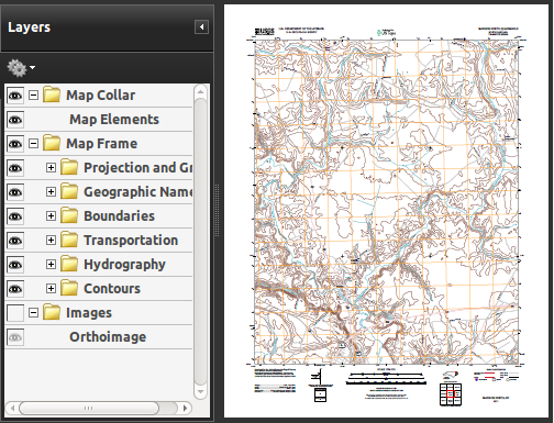
The first thought a GIS Professional gets on seeing a GeoPDF map is how to
USGS Topo as GeoPDF
get it into GIS application. This particularly would be the case in US where USGS maps are all provided as high quality GeoPDFs and the analyst would want to derive maximum information from the maps.
A good way to get the map into a GIS application would be in the form of high resolution GeoTIFF. USGS National Map suggests using Global Mapper for the purpose [PDF]. When a similar requirement came to me I tried the operation with trial version of Global Mapper.
As Geo-folks are already aware, Intergraph Corporation released its Geospatial Portfolio 2013 earlier in December 2012. The release happens to be unique as Intergraph Geospatial 2013 is the first and only comprehensive solution
that connects all geospatial genres, integrating photogrammetry, remote
sensing, and GIS into a streamlined system and comes from a single vendor. Intergraph has aptly branded this release as United, Modern and Dynamic.
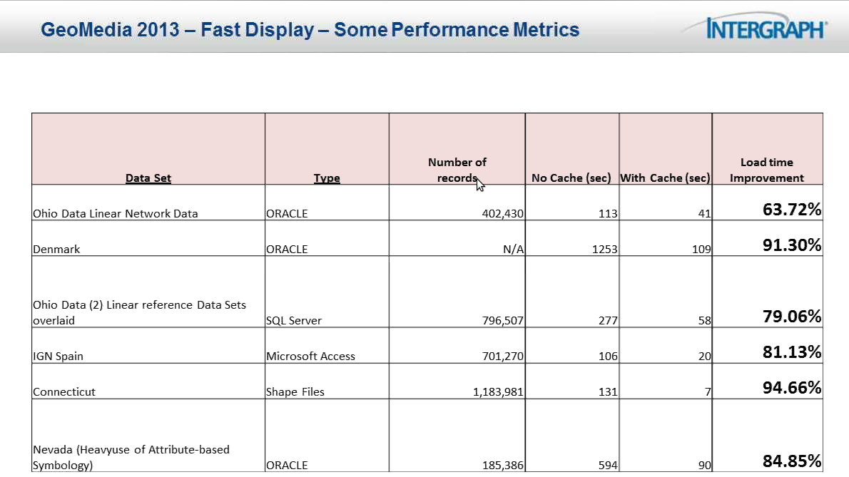
GeoMedia 2013 - Performance metrics with the new caching mechanism
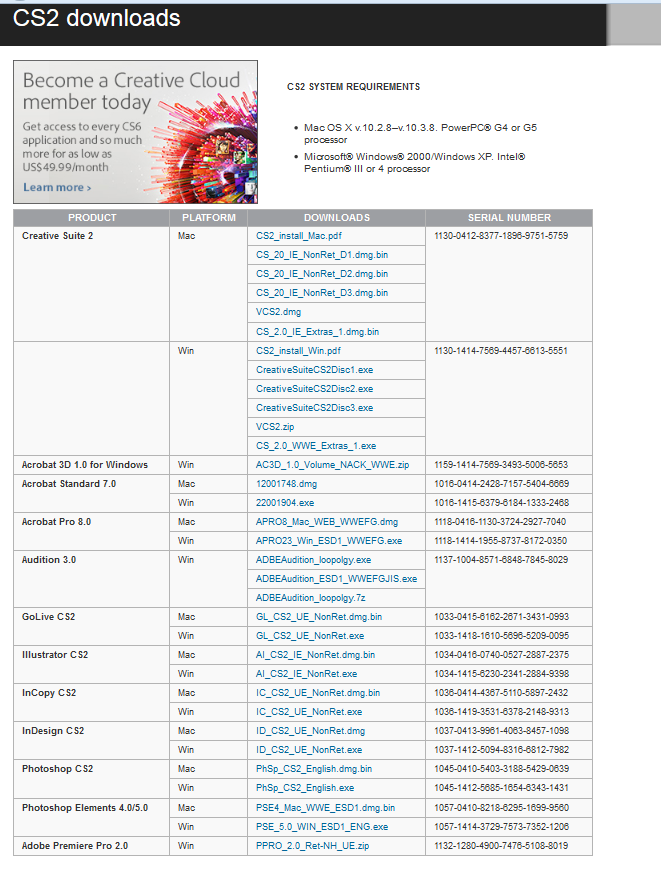
In what may seem as a user friendly move, an offer targeting budget constrained users, Adobe has started giving its 2005 release, Creative Suite CS2 for free [Download here]. The current version of Adobe Creative Suite in market is CS6. A professional user might not feel this is a nice deal but there are many others, especially in developing countries who wish to have Adobe products but simply can’t afford them. This is a blessing for those who use products like Photoshop sparingly and for non-commercial use but wish to use a legitimate product. Despite of having several powerful free alternatives many don’t use them as they are probably aren’t aware of them or simply want to use a leading application in market.
Since 2011 Hexagon Conference (news link), the news of new revamped GeoMedia product is being heard everywhere. It was then announced that the product would be out by end of 2012. And that day is fast approaching! As promised earlier, Intergraph is on the way to release its flagship product by the end of this year in December. After acquisition of ERDAS and Intergraph by Hexagon many good things have happened. Intergraph was always seen proudly proclaiming about the benefits of having two great products from the same vendor. Synergy series webinars hosted last year showcased what things are in store for customers using both the products. (Read how ERDAS Imagine and GeoMedia are live linked). This post takes you around GeoMedia 2013 and describes what great things are enroute.
Indian Railways Center for Railway Information System (CRIS) and RailYatri.in have jointly launched RailRadar for tracking Indian trains. RailRadar enables users to track moving trains in near-real time (the information is delayed by 5 or more minutes). Till recently train running information was available to a user in textual format - a user enters train name/number and the system provides appropriate information like next stoppage, estimated arrival time etc. With RailRadar all this is set to change. A user is presented with ubiquitous Google Maps showing trains running across the nation. Hence this is a giant leap by Indian Railways in terms of usability!